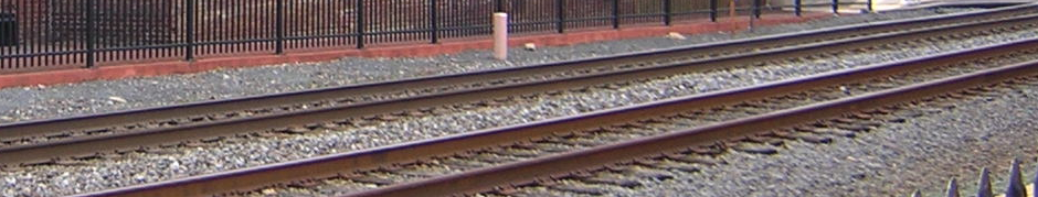
This year’s tour concentrated on local RR lines between Fredericksburg, Virginia; Orange, Virginia; and Gordonsville, Virginia. Also visited was the configuration of tracks known as a ‘Y’ (wye) which was used to turnaround a locomotive or an entire train. It constitutes the locomotive equivalent of an automobile doing a “3 point reversal” on a narrow road.
Last year’s tour was “years in the making” due to work schedules and random life events. This year’s tour was “spur of the moment” by comparison — mentioned in conversation on a Wednesday and executed the following Sunday. In reality, there was careful planning on the part of Don the “fearless trike-ridin’ railroad tour master.”
I like these tours because they’re local. You can ride them in several hours, enjoy refreshments on the road at eateries you may already know, and at the end of the day, you get sleep in your own bed. Also, these tours can be splendid day rides that would make for a challenging photo scavenger hunt from any vehicle (but motorcycles are best).
 The first such photo prize, captured by Don’s bride riding pillion on his trike, is the sign pictured here. It turns out that the road which presently serves private houses, driveways, and yards was at one time the right-of-way (where the tracks were laid) for part of the old narrow gauge (three foot) Virginia Central Railway. This railway
ran from Fredericksburg west, roughly paralleling Route 3, Route 621, where
it met the old Orange & Alexandria Railroad near present day Route 20 and
then south roughly along Route 20 into Orange.
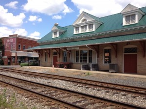
Motoring along Virginia Route 20, we rolled into Orange and stopped at the Orange Train Station. The building is well maintained as both an actual train depot and the county visitor center. Except for the modern heating and cooling systems, the structure has all the stereotypical characteristics of your “Lionel” train station.
Riding local or long distance, two riders *will* become separated by traffic. This ride encountered that very situation albeit somewhat self induced.
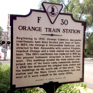
I was to make a RIGHT turn just after the historical marker sign pictured here. I missed it entirely. Don didn’t. I wondered aloud to my bride seated behind me, “Where did Don get off to?” Waiting next to a curb near a traffic light, I looked back and caught sight of the sign I’d missed. I retraced my route, and found Don patiently waiting in the parking lot. (Note to self: Pay attention to directions!)
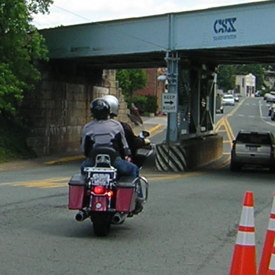 Next on the tour was Gordonsville. We traveled south on Main Street where this former Chesapeake & Ohio (C&O) bridge now takes CSX traffic west towards Charlottesville and beyond.
I proceeded under the bridge to facilitate this photo by our trip photographer. It’s the best we could do for an “action shot” without video.
Then I motored on and turned left into a bank parking lot thinking Don would follow when automobile traffic would allow. On the other hand, Don expected to see me return when automobile traffic would allow. (The next stop of the tour required a left turn BEFORE the bridge.) Both riders are waiting on the other and it was now a matter of “who will come for who first?”
So here comes Don south on Main. At the moment he rides by, I launch into the road making a left. Just as I clear the lane and begin to straighten up, Don has conducted a tight U-turn to proceed north and is passing me in the opposite direction. As he passes, I immediately execute a U-turn. To a pedestrian, I’m certain our maneuvers mid-lane on Main Street looked something like a motorcycle “doesy-doe.” The quick succession of leans and turns made an impression on my bride too. The conversation went something like this:
Mare: What are we doing?
Ed: Making a right turn.
M: But I felt us leaning LEFT.
E: Consecutive lefts at a certain point become the equivalent of a RIGHT. And that’s what we did.
M: In the parking lot?
E: No. On Main Street.
M: Is that safe?
E: Sure. As long as no cars are around.
M: Is that allowed?
E: Sure. As long as no cops are around.
M: You’re nuts.
E: Who’s nuts? Me? Or you for sitting behind me while doing these antics?
M: < WHACK !!! The sound of a hard slap to the side of my helmet! >
But it got us heading back under the bridge to the road leading to the Gordonsville Tower.
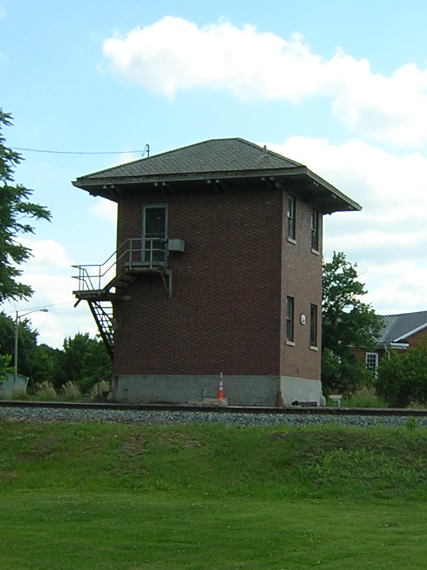
Known on the railroad as G Cabin, this structure is
located inside the wye and is the interlocking tower for all the switches controlling the tracks around Gordonsville.
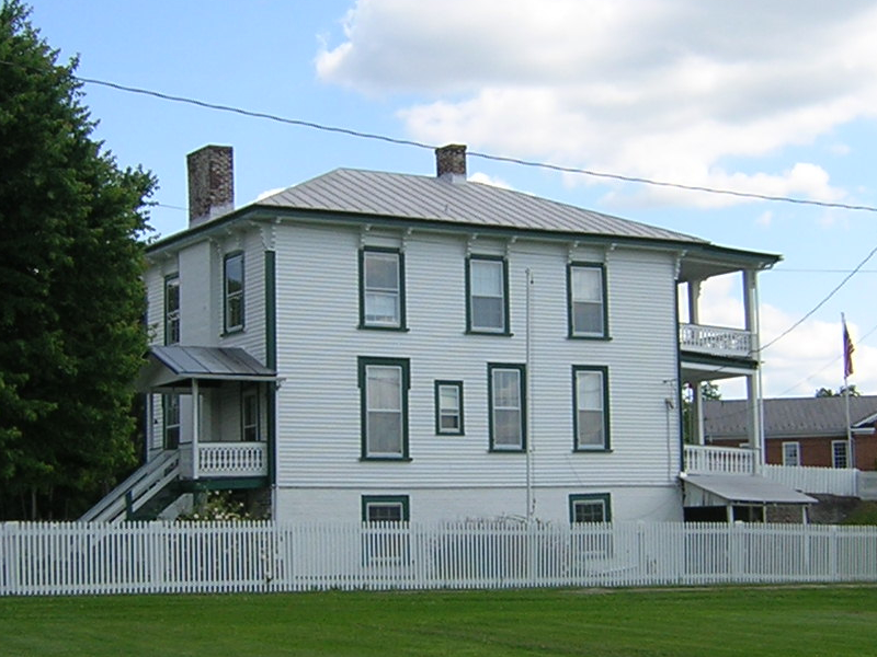
The Magnolia House was built as a hotel around 1873, it became a private
residence about 15 years later. It is outside the wye tracks near G Cabin.
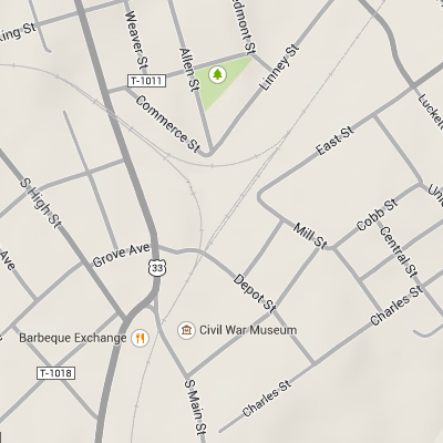
With a tip-o-the-hat to Google, the wye is very apparent on the accompanying map. Retracing the path of locomotive, one can understand how the direction reversal is accomplished without the aid of a large turn table.
By the time we reached the the south end of the wye (looking towards G Cabin here), we had rumbled across all four crossings seen on the map.
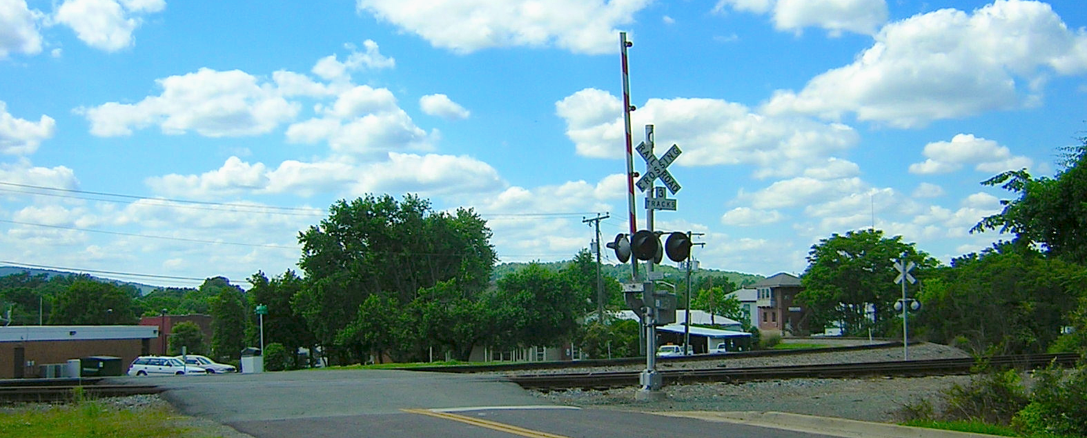
The final stop looking north marked the end of the tour. Thanks again, Don for the pleasurable ride and all the interesting railroad trivia at each stop. (And filling in some details for this same write-up.)
As a former lead rider for many White Plains, N.Y. H.O.G. events back in the day, I can confirm that it is not a good Sunday without at least a couple of u-turns and oh yes, the sweet aroma of cow poop 😉 (I see you didn’t mention that!)
Thanks cuz, for letting me know you are, in fact, “Still alive and well… every now and then you know it’s kinda hard to tell…” I’m headed full throttle into another 50 hour work week tomorrow morning but, maybe we can catch up in the evening. God’s best blessings to you and yours. Love ya, Pamela